


Launching a passion project that's been in the works for two years

This is a slightly-off topic post (although discerning readers can probably detect the throughline) but I wanted to send a note about the launch of a small passion project I’ve been working on for the last couple of years.
The short version is that it’s the launch of a free, digital archive dedicated to the art of the Sanborn Fire Insurance Maps.
If you don't know about the maps, don't feel bad. I only discovered the maps myself by happenchance about 10 years ago (more on that below) but they are a very cool historical phenomenon in the U.S. and this archive is the first place where you can now easily find all of the incredible typography & art from the entire run of the famous Sanborn maps.
If you want to jump right in, you can check it out here!
But I thought I’d also share the quick backstory of how I got into this.
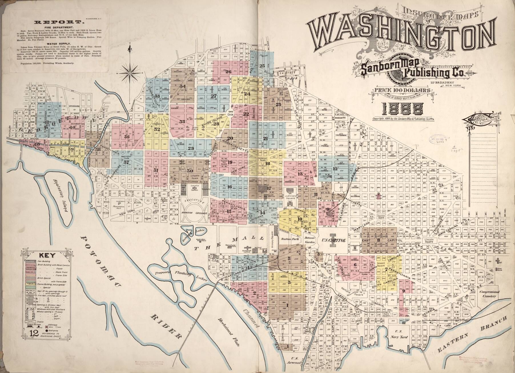
On September of 2011, I saw a post on the famous design blog kottke.org that linked to a small collection of incredible typography from something called the Sanborn Fire Insurance Maps. I had never seen them before and they completely blew my mind. They were full of art like this:


I was totally blown away by the titles.
In fact, my wife & I ended up deciding to model our wedding invitation off of the titles. You can see a timelapse of the whole process of drawing our Sanborn-inspired wedding invitation here. The invitation is still hanging in our house today.
But as I read more and more about the maps, it became obvious that there was no particularly good place to go if you wanted to see *all* of the amazing art from the Sanborn maps. The BibliOdyssey post was literally one of the best collections online and it only had about 30 of them.
So, a few years ago, I began trying to collect and organize all of the titles.
The entire Sanborn map collection includes over 700,000 images documenting 12,000 cities across the United States and scattered across 50,000 separate volumes. It is a massive collection. But only a tiny percentage of the pages have any of the amazing typography. The good news was that majority of the maps have actually been digitized and a large percentage is available online at the Library of Congress. There are also a lot of maps that weren’t at the Library of Congress and instead sit in various university libraries around the country…some of which are well organized and some of which aren’t.
However, even for the best organized digital collections, it’s not easy to find the actual title pages and art.
After two years, I’ve managed to collect almost all of the art and that’s what this website is dedicated to.
It’s made up of almost 3,500 pages that have some unique decorative titles on them (and were drawn before 1923 and in the public domain). It's completely free and almost all of the images are available in the highest resolution formats that I could find from each of the online libraries.
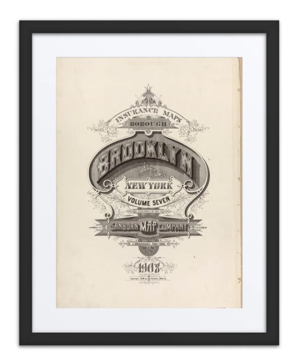
However, in addition to the archive, I’ve also added some e-commerce to help cover some of the cost of the archive and eventually potentially donate to an actual archiving organization. I’m going to keep adding more products over time but for now, I’ve broken it down into a fairly random collection of products across some major metropolitan area.
Most importantly, though, you can order high-quality, framed prints of any of the images…prints like this Brooklyn cover from 1908:
There’s even some swag like t-shirts and water bottles. And if you order any now, they’ll arrive in time for the holidays! They make great gifts :).
This is purely a passion project and if you have any feedback or advice or thoughts, I’d love to hear them. There are still a lot of things that could be improved about the archive (including some bugs I still run into occasionally) and I’ll be working on them over the next few weeks and months, but if you have observations, advice, or other ideas please let me know!
So, all that being said, you can find the archive here!
I also shared the news on Bluesky, Instagram and Threads as well.
All the best,
Brandon
P.S. Sidenote: If you’re interested in learning more about the history of the maps, they are actually a very cool phenomenon of history and fun to learn about (there’s a great short documentary on YouTube where you can get started). They represent the most detailed collection of urban history that exists in America and they are regularly used by historians, urban designers, anthropologists and more.
If you go to a local library in the U.S., chances are good that there will be a collection of original Sanborn maps that you can check out. This the collection at our local library here in Oakland:


Very, very cool! One nit: when viewing by state, paging doesn't work. For example, https://sanbornfiremaps.com/art_state/washington/page/4/ shows page 1, not page 4.